Advertisement
Filters
Map
List
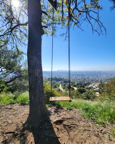
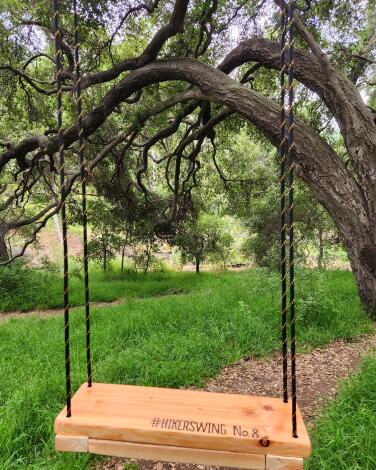
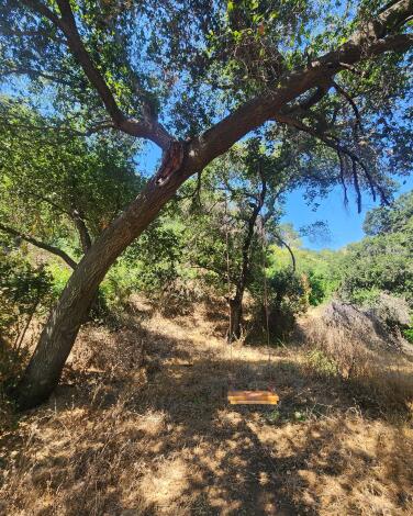
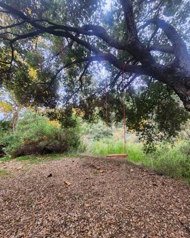
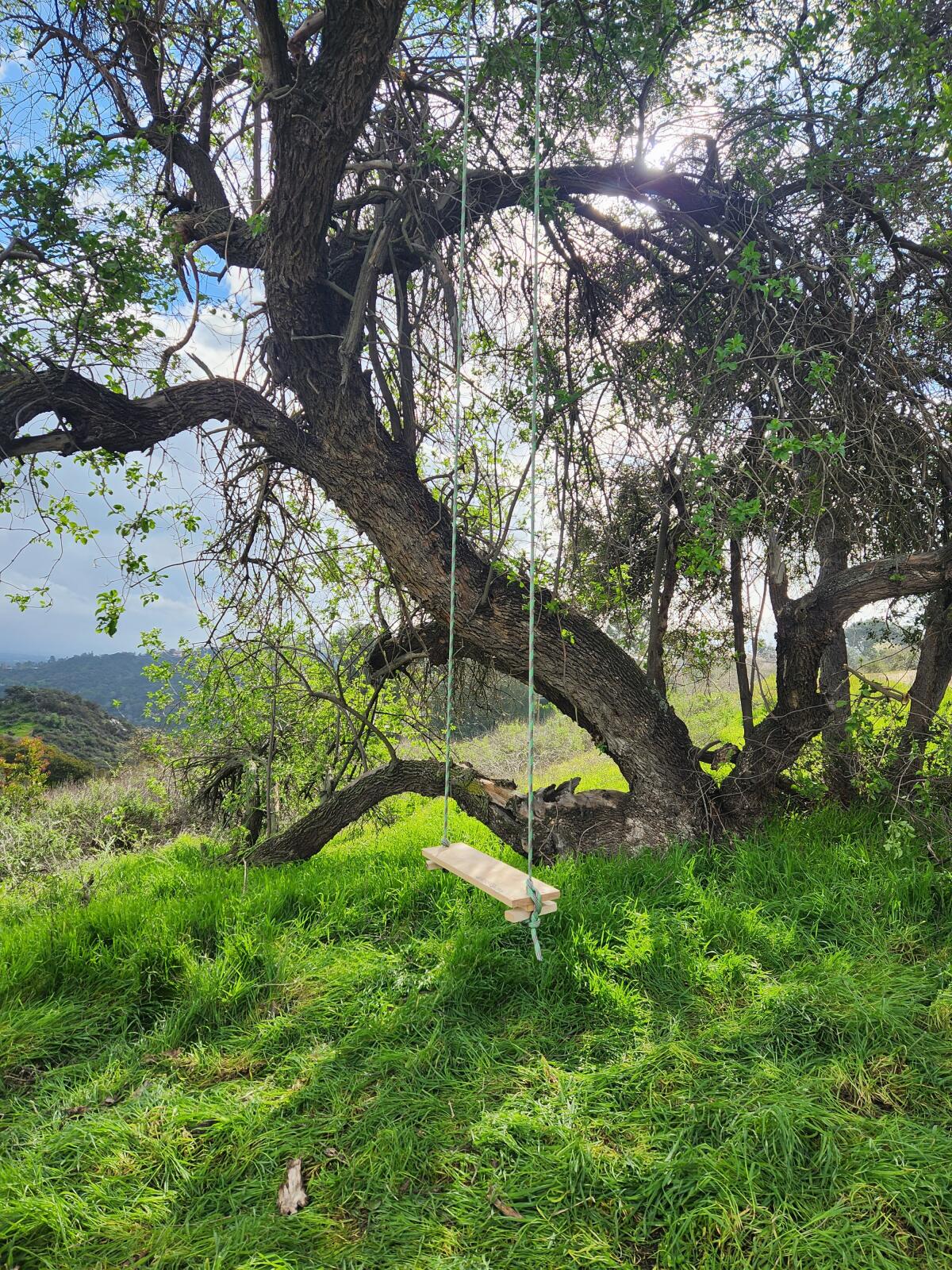
A swing on the Cherry Canyon hiking trail near La Cañada Flintridge.
(Jes Grosky)

Wheee! Here are 15 SoCal hiking trails with hidden tree swings

Jes Grosky and her boyfriend, Keith Shelter, were out for a hike near their home in Downey one weekend when they walked by a tree with a swing hanging from its branches near the trail. The tree was on private property so they didn’t use it, but the sight of it hit a nostalgic chord that stuck with them. “I just really wanted to get on and swing,” Grosky remembers.

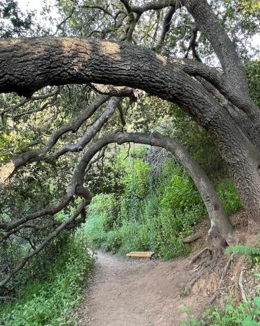
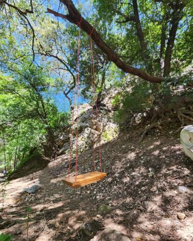
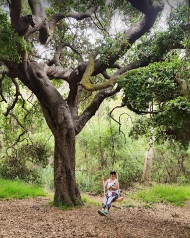
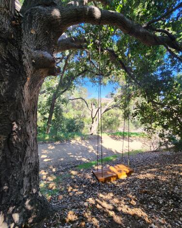
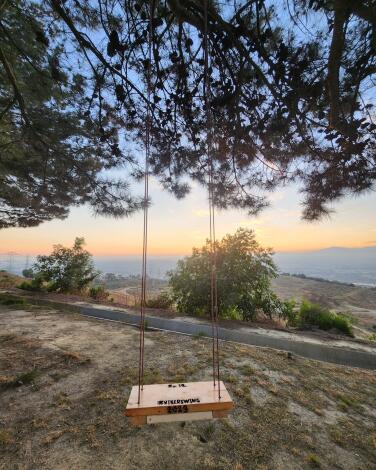
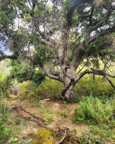
This sparked a simple idea. Why not build some rope swings and start adding them to their favorite trails? The couple, who on most weekends can be found with their hiking boots laced up, wondered if people would feel the same they did. “We wanted it to be a little surprise moment for people. Something for them to discover on the trails,” Grosky says. Their hope was that it would inspire people to get out more and reconnect with nature. In the last year, they’ve put up 19 swings and are hoping to keep expanding. To help spread the word, drop location hints and share other hikers’ discoveries of the swings, the couple also started an Instagram account, @HikerSwing.

Planning your weekend?

Stay up to date on the best things to do, see and eat in L.A.

The trick to finding the perfect swing-ready trail? “We discovered that for some properties controlled by the county you do actually need permits, so right now we try to focus on trails that are managed by the Bureau of Land Management,” says Grosky. “And we look for trails that aren’t too challenging but are harder than just an easy stroll.” The first swing they ever put up, Hiker Swing #1, was on the Cherry Canyon Park Trail in the San Rafael Hills near La Cañada Flintridge. In the future, they’re thinking about making rope swing kits that they can sell, or other fun merch just to keep the momentum and excitement going.

Advertisement

“The community does seem to love these swings,” Grosky says. “It’s so shocking to see the kinds of comments we get on Instagram, the people who tell us they found a swing and got so excited.”

Here are 15 trails with hidden swings. If you plan to head out and search for a swing, be aware that some hikes may require a fee or other permits, so check beforehand. And note that this map includes the locations of the trailheads or parks. Specific coordinates for the swings are not available, but all are in plain sight, so keep your eyes peeled.

Grosky and Shelter have also been informed by swing seekers that some swings have been getting removed. If you don’t see a swing on a trail that should have one, send them a message on Instagram so they can keep tabs on their list.
Showing  Places
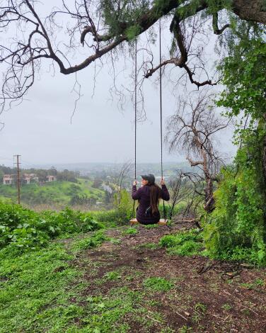
A photograph of a tree with a swing from the Ernest E. Debs Park hiking trail.
(Jes Grosky)

Ernest E. Debs Regional Park

Montecito Heights Park Trail
5.1-mile loop
Easy
400
Ernest E. Debs Regional Park, spanning 300 acres of former ranch land, resides quietly in the Arroyo Seco neighborhood just northeast of downtown L.A. Despite its proximity to the bustling city, this hidden gem remains largely undiscovered, often overlooked by those who have driven past it not realizing the bounty within. “We love the cute little lake and awesome city views of Los Angeles,” says Grosky. “It’s great for families and picnics!”
Route Details
A photograph of a tree with a swing from the East Boy Scout hiking trail.
(Jes Grosky)

East Boy Scout Trail

Griffith Park Mountain Trail
1.4-mile out-and-back
Easy
383 feet
The Griffith Observatory is a magnet for urban hikers, and for good reason. There’s almost always a great view of the city from the patio that wraps around the Art Deco gem. And its position overlooking the other gem of L.A. ‘s urban hiking scene, Griffith Park, doesn’t hurt either. There are numerous trails that lead up to the observatory. This one attacks the climb from the east side near the Greek Theatre. Park near the intersection of Vermont Avenue and Vista De Valle Drive/Commonwealth Canyon Road and walk west. Once you reach a row of parking spaces for the Greek Theatre, look for a fire road that rises up into the mountains, near a picnic table area. This is the start of the trail.
Route Details
A photograph of a tree with a swing on the Fryman Canyon hiking trail.
(Jes Grosky)

Fryman Canyon Trailhead

Hollywood Hills West Canyon Trail
3.0-mile loop
Moderate
463 feet
Nestled into the Hollywood Hills above Studio City and West Hollywood, this nicely groomed trail is a peaceful alternative to the more crowded options nearby (i.e. Runyon Canyon). The trail is considered an easy loop but does include some elevation gain, so you’ll feel like you got a real workout. And on the Studio City side of the trail, you’ll follow a fire road that hugs the properties of some nice homes for those who like to backyard-peep. In the spring and summer, the trail is crowded with beautiful wildflowers.
Route Details
A photograph of a swing on a tree on the Millard Falls hiking trail.
(Jes Grosky)

Millard Canyon Falls

Mountain Trail
1.2-mile out-and-back
Easy
246 feet
This out-and-back trail is great for families and on-leash dogs. Nestled in the scenic foothills of the San Gabriel Mountains just north of Altadena, it “involves about five to six creek crossings as you make your way to the waterfall,” says Grosky. Enjoy late-winter sunlight filtering through trees, creating a very serene ambience. As you make your way up the trail, you’ll be rewarded with breathtaking views of the surrounding mountains before you reach the pièce de résistance awaiting at the trail’s end — the Millard Canyon Falls. A picturesque cascade tumbles down moss-covered rocks, providing a refreshing oasis for those seeking solace in the heart of Southern California’s stunning wilderness.
Route Details
Advertisement
A photograph of a tree with a swing from the Eaton Canyon hiking trail.
(Jes Grosky)

Eaton Canyon Falls

Pasadena Canyon Trail
3.5-mile out-and-back
Moderate
446
Another out-and-back trail with loads of creek crossings, be on the lookout for an abundance of wildlife. “We’ve seen lizards, frogs, a lot of birds,” Grosky says. This trail captivates with its diverse scenery, guiding hikers through shaded canyons and sun-kissed slopes. As the path unfolds, the majestic San Gabriel Mountains loom in the backdrop. The rhythmic gurgling of Eaton Creek is a great soundtrack for the journey, leading to a crescendo at the trail’s climax — the beautiful Eaton Canyon Falls. Spilling over from a rocky precipice, the falls offer a refreshing respite, inviting explorers to bask in the beauty of this Southern California gem. Winter temps might make it a little cold for wading into crisp mountain waters, but it should also keep crowds at bay, as this hike gets very popular during the hotter summer months.
Route Details
A swing at the Big Dalton.
(Jes Grosky)

Big Dalton Canyon Trail

Canyon Trail
3.5-mile out-and-back
Moderate
This out-and-back trail in the Angeles National Forest near Glendora is considered a pretty easy hike, great for beginners or families with small kids. You’ll hike along a gurgling stream near the campgrounds and there are decently kept bathrooms and fire pits for day use and camping. This trail also has a beautiful grove of trees. To start this hike, find the trailhead for the Mystic Canyon and Dalton Canyon Trail. A right will lead you to the start of the Dalton Canyon Trail. Follow the creek up the canyon and past an amphitheater near the campground. Once you reach a point that crosses over the culvert, you’ll see Big Dalton Road.
Route Details
A photograph of a tree with a swing on the Temescal Canyon hiking trail.
(Jes Grosky)

Temescal Canyon Trail

Pacific Palisades Canyon Trail
3.0-mile loop
Moderate
833 feet
This 3-mile loop inside Topanga State Park unveils a tapestry of chaparral-covered hills and ancient oaks. The trail leads you along a meandering path, shaded by lush canopies and offering glimpses of vibrant wildflowers when it’s blooming season. It also offers panoramic views of both the Santa Monica Mountains and the Pacific Ocean. The first half of the trail is a steady uphill climb, but it’ll be worth it at the end.The pinnacle reveals the small-yet-majestic Temescal Canyon Falls, a serene oasis nestled in the heart of the rocky landscape. There is a fee for parking.
Route Details
A photograph of a tree with a swing from the Black Walnut Hiking Trail.
(Jes Grosky)

Black Walnut Trailhead

La Habra Heights Canyon Trail
2.2-mile loop
Easy
383 feet
This scenic loop trail in the Puente Hills Preserve is a good hike for beginners and moderate hikers. While a lot of the trail is exposed, it does wind through a shady canopy of black walnut trees that provide a canopy of shade. You’ll also be treated to an exciting blend of flora and fauna, as sightings of deer, coyotes and a handful of wild birds are commonly reported. If the parking lot is closed, there is street parking available nearby.
Route Details
Advertisement
A photograph of a tree with a swing from Cherry Canyon hiking trail.
(Jes Grosky)

Cherry Canyon Park Trail

La Cañada Flintridge Park Trail
2.1-mile out-and-back
Easy
400 feet
Nestled in the San Rafael Hills near La Cañada Flintridge, the Cherry Canyon Park Trail is a good entry-level hike for anyone just starting out or in the mood for a less strenuous stroll. It’s also the first swing that Grosky and Shelter put up. “We chose this trail for the cool mountain views and nice paved trails at some points for an easy hike,” Grosky says. Aside from stumbling onto the first Hiker Swing, there’s an old fire tower at the top and a fittingly named vista point called Ultimate Destination.
Route Details
A photograph of a tree with a swing on the Nike Hill hiking trail.
(Jes Grosky)

Nike Hill

Hacienda Heights Urban Trail
3.8-mile out-and-back
Moderate
987
This out-and-back fully paved trail perched in the Puente Hills Preserve is a popular spot with locals. And it’s easy to see why. It offers a moderate hike through rolling hills adorned with native flora. As you rise in elevation, the cityscape transforms into a breathtaking vista of Los Angeles and beyond. Nike Hill, named after a former missile site, combines historical intrigue with natural beauty. Whether seeking a brisk workout or a peaceful sunset retreat, this trail delivers an enriching experience.
Route Details
A photograph of a tree with a swing on the Native Oak Trail.
(Jes Grosky)

Native Oak Trail to Coyote Loop

Hacienda Heights Mountain Trail
4.7-mile loop
Moderate
1,167
“There are tons of switchbacks leading you up and down into tree groves,” warns Grosky of this trail near Hacienda Heights. “So it could definitely be seen as a challenge.” But between the tree groves there are areas of lower-lying brush that do allow for pretty incredible views of the surrounding valley. This route also connects to the Ahwingna Trail or the Schabarum-Skyline Trail if you’re craving further exploration after your session. Also good to know: the parking lot and gate don’t open until 9 a.m.
Route Details
A photograph of a tree with a swing on the Escondido Falls hiking trail.
(Jes Grosky)

Escondido Falls

Unincorporated Santa Monica Mountains Canyon Trail
3.5-mile out-and-back
Moderate
475
This easy, beginner-friendly trail cuts through a diverse landscape, from shady canyons to sunlit chaparral. As you traverse the path, enjoy the soothing sounds of Escondido Creek leading to the Escondido Falls. Lush greenery and vibrant wildflowers frame the trail, creating a picturesque escape that feels like it’s just footsteps away from the iconic Malibu coastline. There is a small parking lot that charges a fee to park there. But parking along the Pacific Coast Highway is also an option.
Route Details
Advertisement
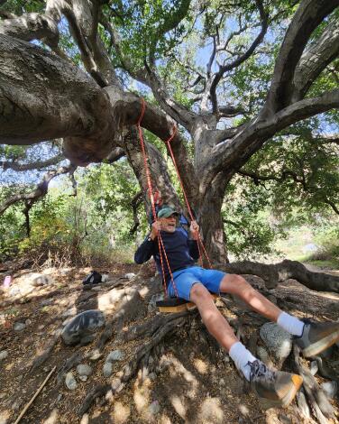
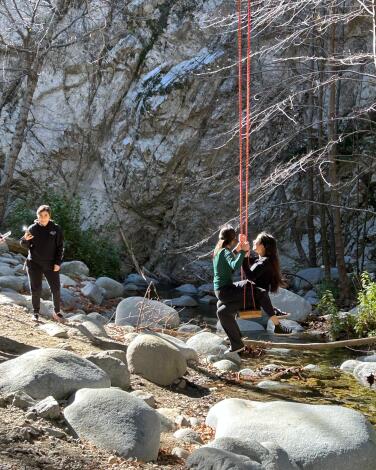
Hikers enjoy a swing places near Swtizer Falls, in the Angeles Nationa
(Raul Roa/Los Angeles Times)

Switzer Falls Trail

Mountain Trail
3.7-mile out-and-back
Moderate
695 feet
The winter months are ideal for this hike, as the chilly weather keeps both bugs and crowds at bay (although it remains a popular trail year-round). “You’re walking through the canyon along the trees for most of the hike,” says Grosky about this out-and-back trail in the Angeles Mountains. “But you do go up above the tree line for some pretty views.” The final half-mile or so is dipping back down near the river until you hit Switzer Falls. Grosky recommends bringing walking sticks or poles.
Route Details
A photograph of the Horsethief Canyon trail.
(Jes Grosky)

Horsethief Canyon Trail

San Diego County Canyon Trail
1.3-mile out-and-back
Moderate
511 feet
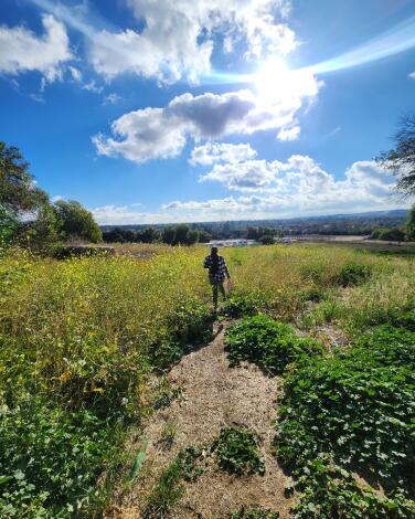
This “short and sweet” out-and-back hike is “challenging but with a fantastic view,” according to Grosky. The trail weaves through a picturesque landscape, offering a blend of oak-studded hillsides, chaparral-covered slopes and panoramic vistas of the San Gabriel Mountains. As hikers ascend, the trail unfolds with a mix of shaded areas and sunlit expanses, creating a visually appealing journey. Pack a lunch or bring some hearty snacks and grab one of the benches at the top for a meal with a million-dollar view. The trails are well maintained and clearly marked.
Route Details
A photograph of a tree with a swing on the Murphy's Ranch trail.
(Jes Grosky)

Murphy Ranch

Brentwood Canyon Trail
3.4-mile out-and-back
Moderate
626 feet
“This hike involves stairs, and lots of them!” warns Grosky. This unique trek takes hikers to the remnants of a 1930s Nazi sympathizer compound, now fully taken over by nature. The trail winds through canyons revealing graffiti-covered structures and rusting machinery that add a fascinating (and sometimes eerie) historical layer. As hikers explore the rolling hills, panoramic views of the Pacific Ocean and lush landscapes unfold. The road going up is a bit over a mile and fully exposed to weather until you hit the stairs, which take you straight down into the canyon.
Route Details
Advertisement